

Maps and layers
Choose Topo, Satellite, or Hybrid, then use the slope, ownership, and cell coverage overlays.
In Explore, tap the layers icon at the end of the bottom bar. Choose a base map, then turn on the overlays you need. Glassing remembers your choices.
Choose a base map
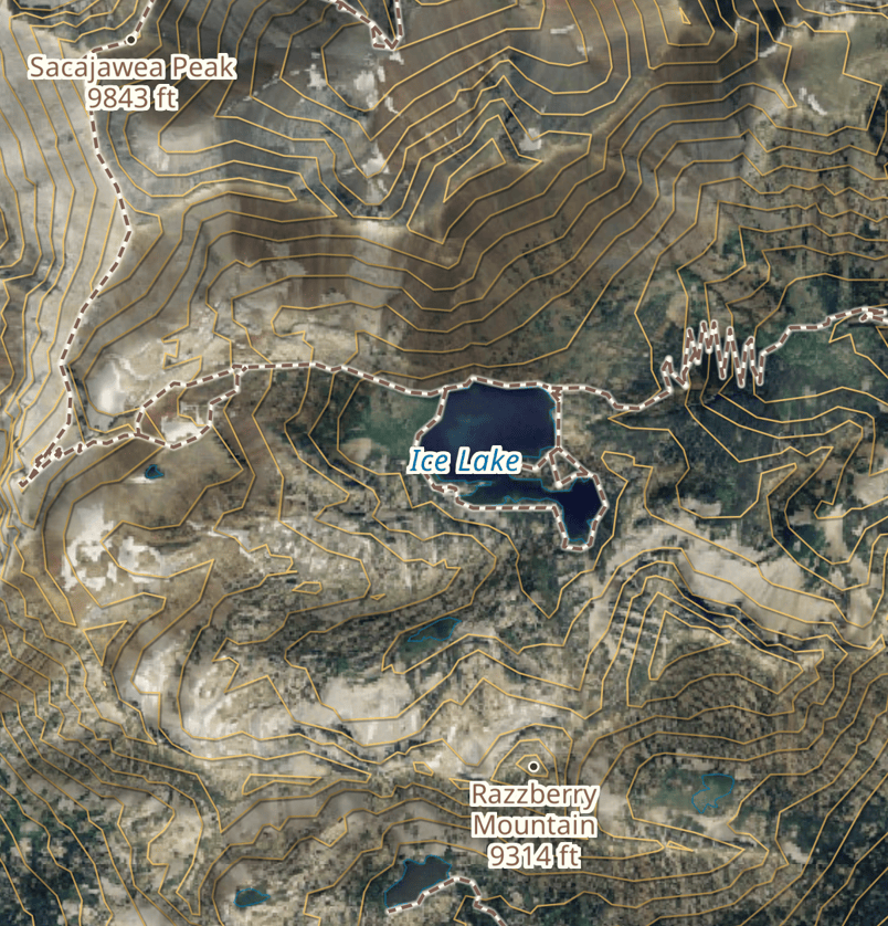
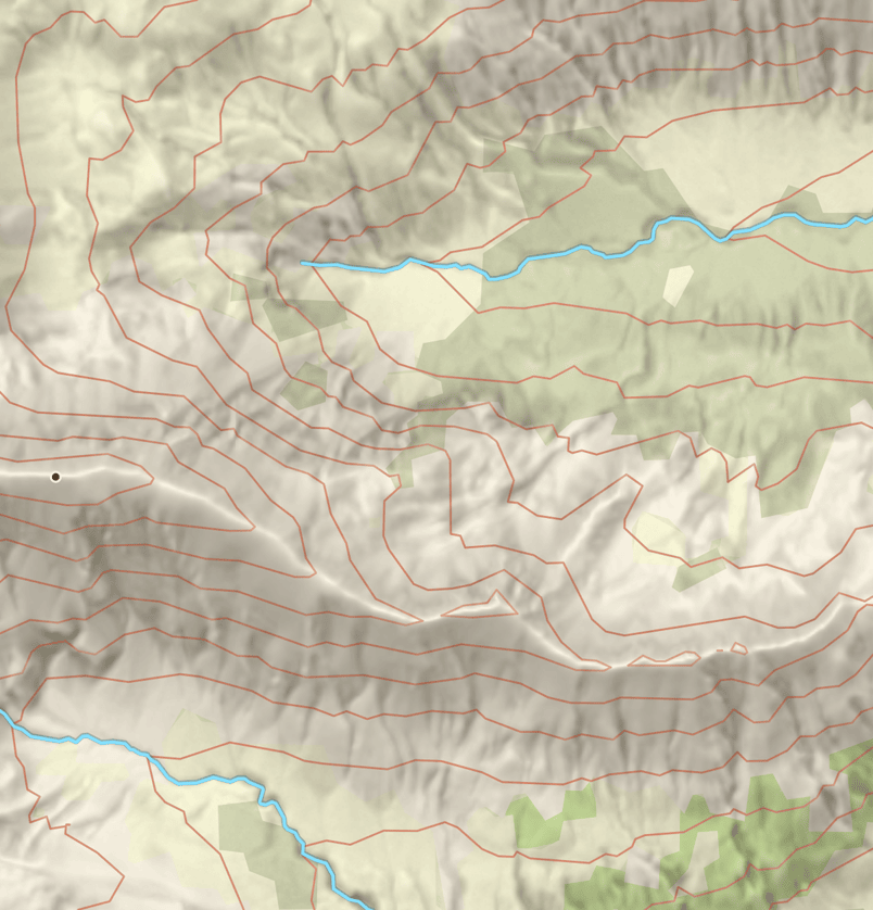
- Topo shows terrain, landcover, water, trails, and contours. Contours are 40 ft apart, with a heavier line every 200 ft.
- Satellite shows aerial photography, untouched. Ownership and Cell Coverage can be drawn over this base.
- Hybrid adds Topo's trails, contours, symbols, and names to the photography. Contours appear in amber.
Use the legend
Open the layers panel and tap Legend. It shows the colors, source, and date for the visible overlays. A Terrain section at the foot of the legend credits the elevation data behind the relief and the slope shading, says when the lidar under the view was flown, and states the ground distance a slope angle is measured over.
Slope
Use Topo or Hybrid and turn on Slope. It starts with Angle, which shows steepness. Tap the left side of the Slope row to reveal Angle and Aspect, then choose one. Aspect shows which direction a hillside faces. Glassing remembers your choice.
Tap the left side again to close the choices, or use the switch on the right to turn Slope off. Opening another overlay's choices closes these.
Angle
Use Angle to compare off-trail routes and spot steep hillsides. In snow, it helps you identify steep slopes when planning travel in avalanche terrain.
The colors show steepness, not current avalanche danger. Check the local avalanche forecast and consider the slopes above your route too. Learn about avalanche terrain.
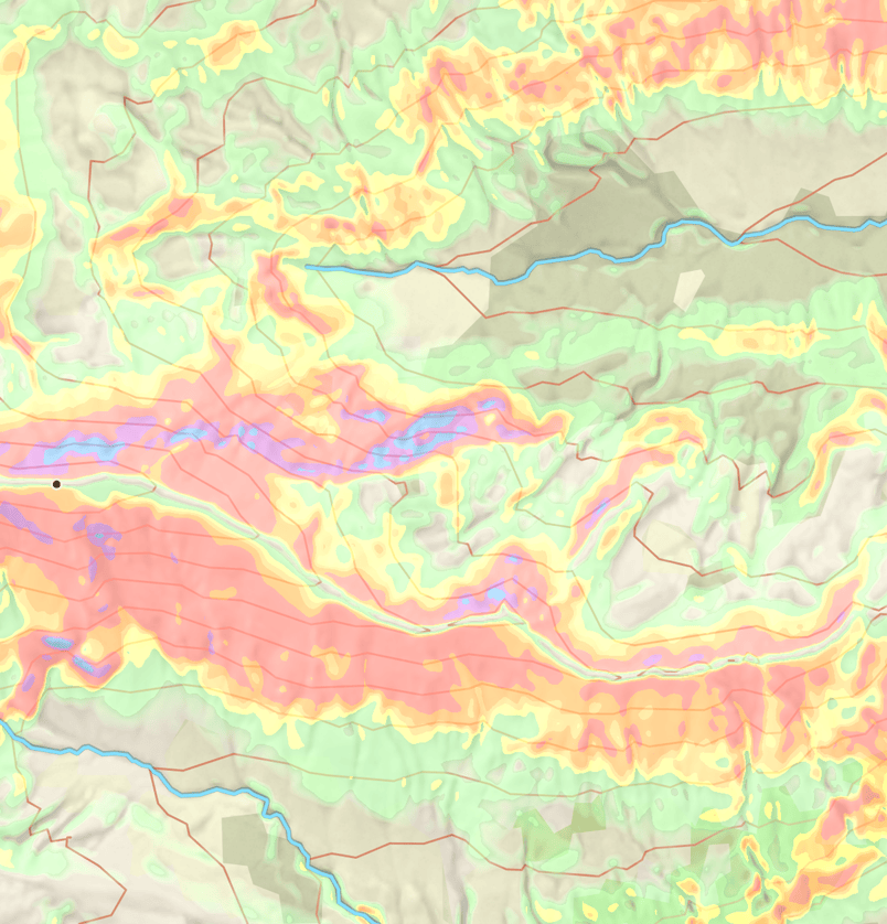
Dark green fades in between 15° and 20°, with different colors for steeper slopes as shown below. Shading is lighter over Hybrid so the photograph stays visible.
Zoom in if no colors appear. In Angle, unshaded ground may be below 15°, outside the data coverage, or too far zoomed out.
| Slope | Color |
|---|---|
| Below 15° | No shading |
| 15° to under 20° | Dark green fading in |
| 20° to under 27° | Green |
| 27° to under 30° | Yellow |
| 30° to under 32° | Light orange |
| 32° to under 35° | Orange |
| 35° to under 46° | Red |
| 46° to under 51° | Purple |
| 51° and above | Blue |
Aspect
Aspect colors a hillside by the direction it faces, not its steepness. Use it to pick out north-facing slopes or compare opposite sides of a drainage.
| Direction | Color |
|---|---|
| North | Navy |
| Northeast | Blue |
| East | Teal |
| Southeast | Green |
| South | Gold |
| Southwest | Burnt orange |
| West | Red |
| Northwest | Purple |
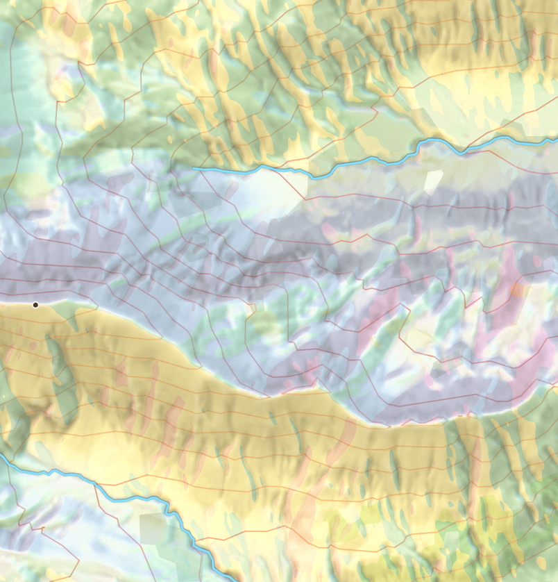
Nearly flat ground has no aspect shading: it starts above 5° and reaches full strength at 20°. Terrain relief stays visible over the colors. Open Legend to check the direction colors.
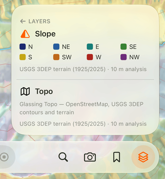
Tap a spot to read its slope and facing direction, such as 32° · NE-facing. This works even with Slope turned off. Nearly flat ground omits the facing direction.
Both options use terrain measurements at roughly a 10 m scale. Small features may not appear. Shading does not tell you whether a slope is safe. Angle and Aspect are also available on the web map.
Terrain relief
Topo and Hybrid include shaded relief to bring out ridges and drainages. It becomes clearer as you zoom in; there is no separate switch. Switch to Satellite for the photograph on its own.
Ownership
Ownership colors public land by its manager and private parcels in tan. Public areas with restricted, closed, or unknown access use a lighter fill. Tap a spot to read its access information. A parcel names its owner only when that owner is an organization; a person, a family trust, an estate, or a trustee is never named, and the parcel's own street address stands in that place.
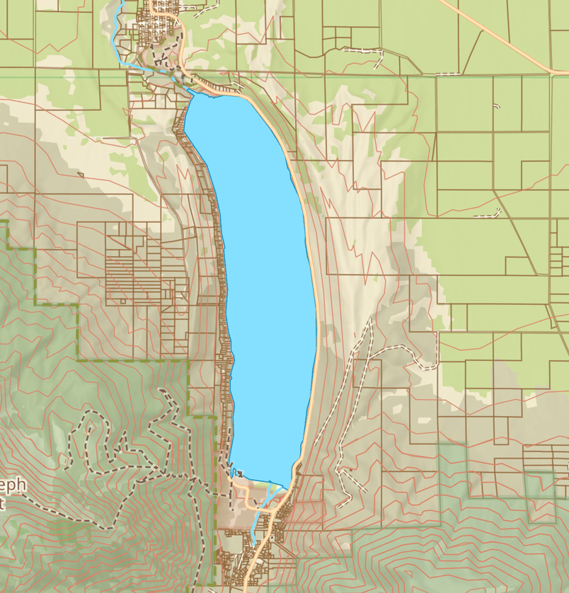
A blank area does not mean public access. See Private land for parcel coverage and access labels.
Cell Coverage
Turn on Cell Coverage and choose AT&T, T-Mobile, or Verizon. The map shows one carrier at a time: darker shading for reported 5G and lighter shading for 4G LTE alone. It works over all three base maps.
Tap the left side of the row to change carriers. Use the switch to turn the overlay off. See Cell Coverage for the legend, point labels, and offline use.
Check Data coverage for available areas and offline layers. See Sources and limits for help interpreting the data.
Need help? Email support.