
Hiking · Hunting · Backpacking · Ski touring
Beautifully simple backcountry maps.
An iOS-native backcountry navigation app with a refined design for quick interactions. Download your maps before you go to find your way without cell service.
For iPhone with iOS 26 or later. $19.99 a year, with the first month free for new subscribers.
Fig. 1 — Explore
The tools you need within thumb's reach.
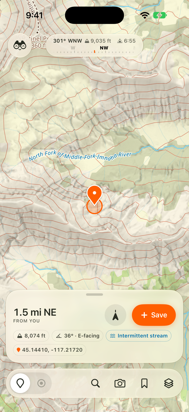
Swipe the bottom bar to explore, record, or navigate. The controls are easy to reach with one hand.
Tap a spot on the map to see its distance, bearing, and elevation. Check sunset before deciding how much farther to go.
- One bar
- Explore, record, navigate
- Large buttons
- Easy to tap along the way
- Made for iPhone
- Familiar controls
Spend your time outside.
The map should be quick to check and easy to put away.
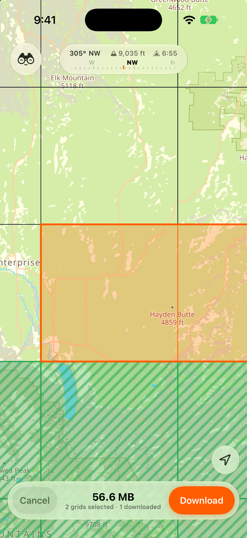
Fig. 2 — Offline downloads
Offline maps you can trust.
Choose the grids for your destination. Your maps and place names download together, so you can search, plan routes, record tracks, and mark places without a signal.
- Everything works offline. Topo, imagery, Slope, Ownership, and Cell Coverage come with the grid wherever that data is available.
- Checked before it’s ready. A map is only marked downloaded after all its files pass verification.
- Keep the working map. An update only replaces your downloaded map after the new files pass those checks.
Fig. 3 — Recording
Press start then go.
Start recording at the trailhead then put your phone away.
- Sips battery. Record through a full day outside.
- Takes a break when you do. Glassing uses less GPS while you're stopped and picks up again when you move.
- Detailed when you need it. Turn on Max detail when you need a closer record of your path, such as following a blood trail or searching for a dropped hat.
Field note. On a recent six-day backcountry trip, an iPhone 15 Pro at 81% battery health used roughly half its battery per day with about seven hours of background recording and 30–60 minutes of foreground use.
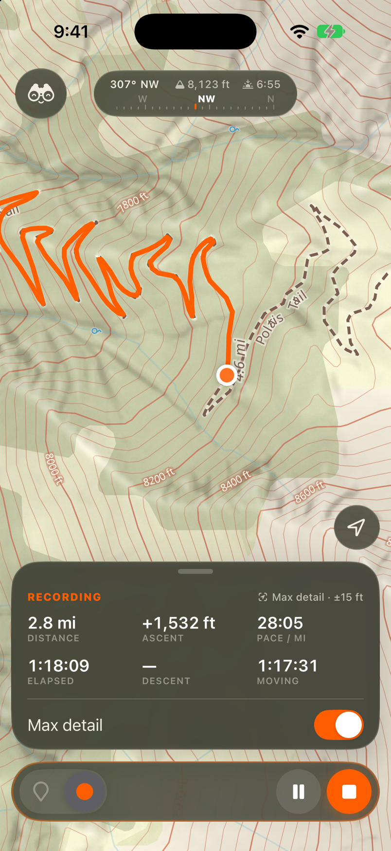
Fig. 4 — Route building
Trails, bushwhacks, and the line in your head.
Draw a route on your phone or the web map. Follow trails with Snap to trail or place points across open country.
See distance and elevation gain as you draw. Drag a point to try another way. Plan and follow your route offline.
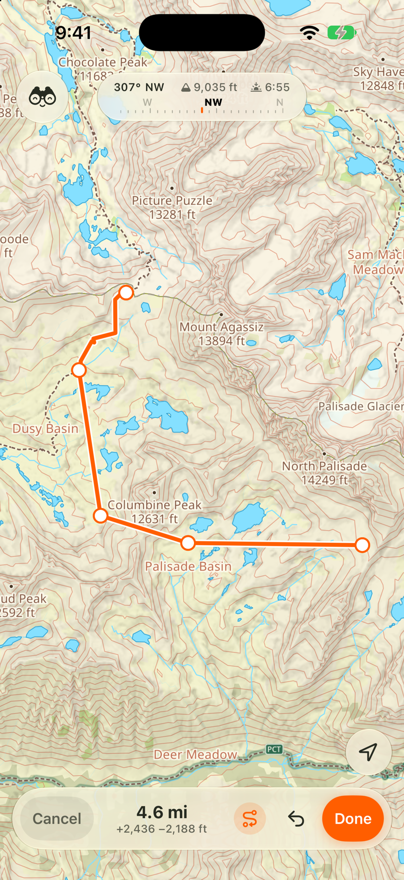
Fig. 5 — Trips
That week in the Wallowas all in one place.
A few years of trips can leave you with hundreds of pins and tracks. Dates and times tell you when you saved them, but not whether that pin was a campsite, a water source, or a good place to glass.
Glassing groups your waypoints, routes, tracks, and photos into trips automatically, named for the place and month. Open “Wallowas, September 2026” and find that week together.
Give a saved pin a symbol or move it to another trip with a tap. There's no need to type a name, and those changes save as you make them.
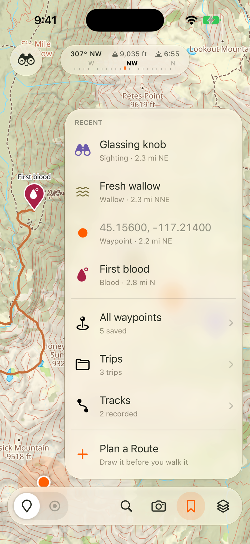
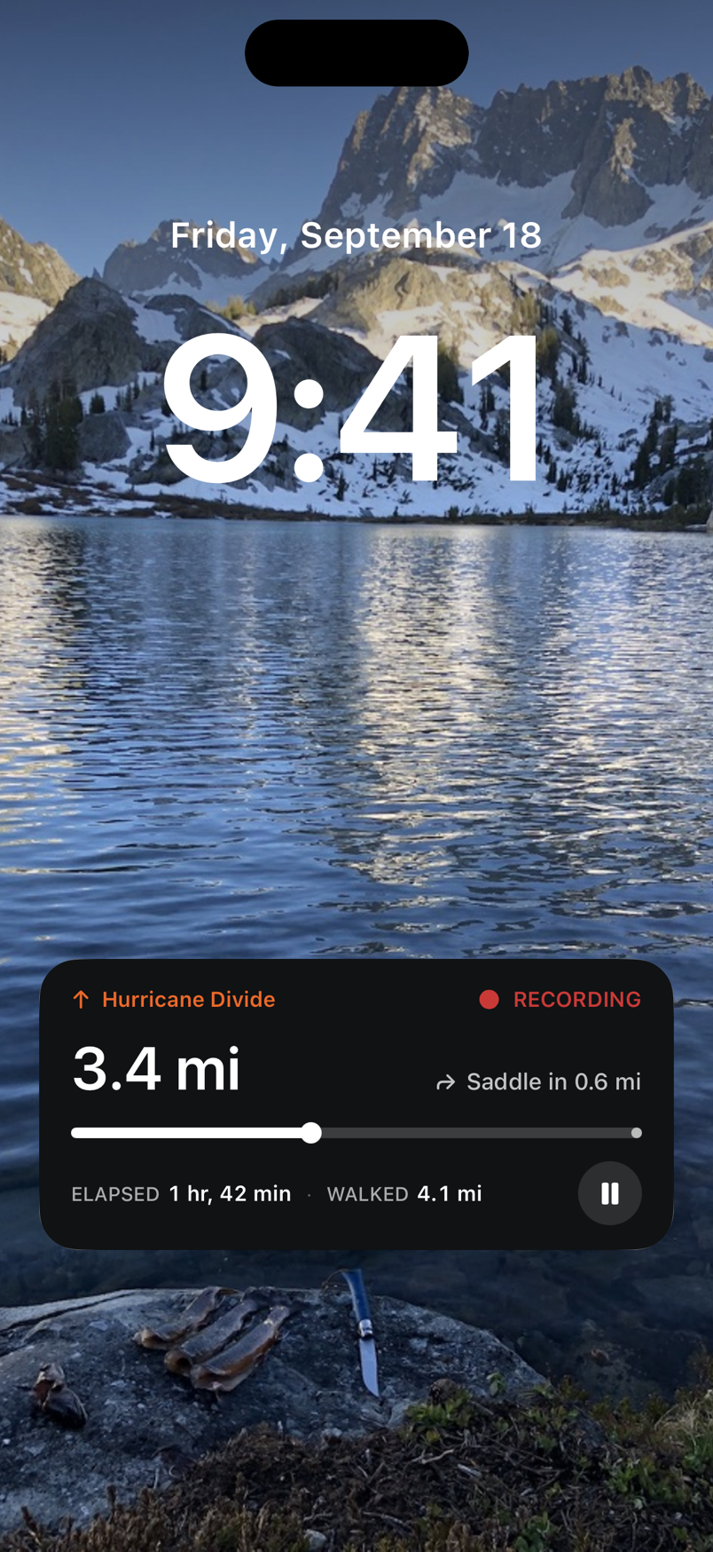
Fig. 6 — Lock screen
Check your progress with your phone locked.
How much farther? Where’s the next turn? Glassing puts the answers on your lock screen.
- Your route and recording, together. One card shows the route you’re following and the track you’re recording: distance traveled, distance remaining, and the next junction ahead.
- Pause without unlocking. Pause or resume your recording right from the card.
- Know when you’re off route. The card turns orange and shows how far you’ve strayed. If your phone is put away, a push notification lets you know.
- Just ask Siri. Start a recording, mark your location, or find your way back to the truck. These actions work with Shortcuts, too.
On your laptop and your wrist too.
In the browser
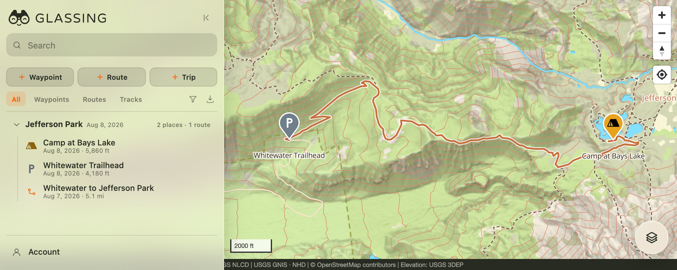
The same map at your desk.
Plan a route on a bigger screen before the trip. Afterward, look through your tracks and photos and sort your saved places.
Use 3D terrain to look over the passes and drainages along your route. Your saved places and routes sync between the web and your phone when connected.
On the wrist
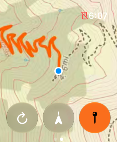
Check the map from your wrist.
See your heading, follow a route, and drop a waypoint on Apple Watch while your phone stays in your pocket.
Start or pause a recording from your wrist. Keep your phone nearby; the watch uses its location and maps.
 Who is behind it
Made by a long-time pin dropper.
I'm Kyle Meyer, a software engineer in Portland, Oregon. I've spent hundreds of nights out backpacking, hunting, hiking and skiing, and I've used every mapping app there is.
Years of my pins are scattered across them — some behind subscriptions I'd have to buy again to even access, some in apps that changed hands or shut down. None of them have ever felt like the purpose-built tool I wanted.
So I made my own — the map I want for me and my friends. One person with a day job, no parent company pushing social features, no feature treadmill. Just a simple navigation app that gets out of your way.
I hope you like it too.
Bring your saved places
Years of trips organized.
Messy in, organized out.
Bring over your GPX, KML, or KMZ files. Glassing suggests trips based on where and when you went and icons for waypoints that need them. Review the suggestions before importing or keep the folders your file already has.
Take your data with you.
Export your waypoints, routes, and tracks as GPX for free, even after your subscription ends. Move to another app whenever you like. Photos can be shared separately.
- 01Export a file from your old app.
- 02Open it in Glassing.
- 03Review it and tap Import.
Yours to keep
Your maps don't need a login.
Your maps stay when you sign out.
Your downloaded maps and saved places stay on your phone when you sign out. An account is for syncing between devices. You don't need to sign back in to use what's already there.
Keep access after your subscription ends.
You get seven days of full access after Glassing learns online that your subscription has ended. After that, you can still use downloaded maps, follow saved routes, and export your places and tracks for free.

Download a map. Try it in airplane mode.
Find a place, plan a route, and head outside.
Maps for the lower 48. Layer coverage varies by area.
Try the web map →- All layers
- free to view
- Map downloads
- included
- Offline navigation
- included
- Web app and sync
- included
- First month, new subscribers
- free
Everything you saved stays on the phone and exports as GPX, and downloaded maps stay usable.